First Some Context for You
At the federal level, Buffalo Field Campaign (BFC) seeks to influence policy and guide decisions toward meaningful, lasting protection for wild buffalo and their habitat. This can be tedious, tiresome, and frustrating work, but it is also some of the most effective.
 Think of it this way: consider what we are doing in the field every year, especially every winter; and what we are doing at the local and state levels—much of this can be made unnecessary if we succeed in getting the Yellowstone buffalo (scientific name: Bison bison) the protection that it truly deserves under the Endangered Species Act (ESA). We are not talking about manipulating the system to achieve some narrow personal or political aim. We seek nothing more than to obtain the legally designated protections which objective science will prove this species requires for its very survival.
Does this mean we are wasting resources as we fight today’s battles in the field? No! You know BFC would never waste your money! The reality is quite the opposite of wasteful: Without the ongoing “blocking and delaying actions” described below, the buffalo will likely be extinct (or replaced with beefalo) by the time we can make an ESA listing a reality. Earning an ESA designation is a long, complex, and expensive process, and the buffalo need protection in the meantime.
United We Stand, for Wild Buffalo
You are an important part of the legislative/political process at the federal level. Your participation is crucial because while BFC is “just one voice”—it is different when agency staffers, committee members, and our elected representatives hear from enough of us (that is: the citizens who put and keep them in office). They begin to understand the truly widespread support for buffalo conservation. They also begin to understand that people vote based upon their beliefs, and buffalo defense becomes their political self-defense.
We are involved in many more activities than we can list, but here we offer you a sampling of our legislative work and objectives at the federal legislative/political level.

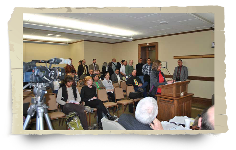
- Congressional oversight hearings: These hearings are the principal (formal) method by which congressional committees gather and analyze information in the early stages of legislative policymaking. Their proceedings normally include oral testimony from witnesses, and questioning of the witnesses by members of Congress. It is not often that such hearings impact buffalo, but when they do, you know we are involved.
- U.S. Government Accountability Office Investigations and Reports: The U.S. Government Accountability Office (GAO) is the investigative arm of the U.S. Congress. In their own words, as found on their website in April 2016, GAO: “...is an independent, nonpartisan agency that works for Congress. We advise Congress and the heads of executive agencies about ways to make government more efficient, effective, ethical, equitable and responsive. Our work leads to laws and acts that improve government operations, saving the government and taxpayers billions of dollars.” Often called the "congressional watchdog," GAO investigates how the federal government spends taxpayer dollars. As such, it has been called upon several times by members of the U.S. Congress to investigate and report on taxpayer funded plans targeting America's last wild bison herds. Historically, GAO has been highly critical of the costly plans that have killed thousands of wild buffalo in Yellowstone National Park and Montana. We propose formal Congressional oversight of all buffalo-killing (and “management”) tax dollars; and of course “we the people” must vigilantly maintain our own oversight of our Congress. It is, after all, the congressional “power of the purse” that could re-direct taxpayer money to truly benefit America's last wild bison in its native habitat. BFC supports fiscal and operational transparency as regards public funds used to destroy this living national treasure. We support GAO investigations with information at every opportunity.
- Hinchey-Bass Amendment: On June 17, 2004, U.S. Representatives Maurice Hinchey (D-NY) and Charles Bass (R-NH) introduced a bipartisan amendment to the 2005 Department of Interior Appropriations Bill to "prohibit the use of funds to kill bison, or assist in the killing of bison, in the Yellowstone National Park herd." Despite the hard work of buffalo protection advocates and hundreds of concerned citizens, the measure failed to pass by an incredibly close 202-215 margin. The National Park Service (NPS), whose insignia features a buffalo, has slaughtered (or allowed to be slaughtered) thousands of buffalo since then. The Hinchey-Bass Amendment would have saved millions of tax dollars while forcing the National Park Service to uphold its mandate "to protect the resources unimpaired for present and future generations." BFC field data, images, and staff/volunteer time were heavily involved in this historic—and nearly successful—endeavor.
- Yellowstone Buffalo Preservation Act: On May 18, 2005, Rep. Maurice Hinchey (D-NY) introduced HR 2428, the “Yellowstone Buffalo Preservation Act.” The bill is stalled in congress, but is designed to protect Yellowstone buffalo “Bison bison” from unnecessary management practices such as hazing (molesting bison with helicopters, snowmobiles, horses, and ATVs), capturing, and killing. Under the bill, bison would be allowed to range in Montana up to the edge of Zone 3 of the Interagency Bison Management Plan (IBMP). Zone 3 constitutes a relatively small portion of land on the west and north sides of Yellowstone National Park (YNP) where bison regularly migrate in winter and spring, but where they face fatal consequences for following their ancient instincts. The bill also establishes sole jurisdiction by National Park Service (NPS) over all bison inside YNP. Currently, under the IBMP, the Montana Department of Livestock (DOL) has authority to “haze” bison that are close to the western boundary—forcing them far back inside YNP. DOL agents commonly haze bison approaching the park border, and use horses and helicopters to force them as many as seven miles into the park. Importantly, this bill goes a step further, and calls for the dismantling of the Stephen's Creek capture facility, which is actually located inside the YNP near Gardiner, Montana, and from which the NPS has sent thousands of bison to slaughter. Last, the bill also directs the Park Service and Forest Service to acquire additional habitat for bison in Montana using such methods as conservation easements and acquisition.
Last, but certainly not least: perhaps the most important action BFC will take to defend, conserve, and protect the last wild herds is our effort to formally prove they deserve to be listed and protected as a threatened or endangered species.
- Endangered Species Act: On 13 November 2014, Buffalo Field Campaign (BFC) and Western Watersheds Project filed a petition with the U.S. Fish & Wildlife Service (USFWS) to list the Yellowstone bison as threatened or endangered under the Endangered Species Act (ESA).
In early 2016, the U.S. Fish & Wildlife Service rejected the information submitted by Buffalo Field Campaign and Western Watersheds Project that listing the Yellowstone bison as threatened or endangered may be warranted. The rejection was perfunctory and did not address the best available information on the wild species.
The next step in the Endangered Species Act listing process is to challenge the agency’s decision in court. Many thanks to the Friends of Animals Wildlife Law Program, a nonprofit lending a helping legal hand as we move forward in our long-term fight to secure a future for Yellowstone bison.
Contrary to public perception, the primary threat to America’s most unique and distinct population of wild bison is Yellowstone National Park’s on-going capture for slaughter operations that have destroyed over 4,000 wild bison in America’s first national park. Beyond Yellowstone National Park, the states of Montana, Idaho, and Wyoming forcefully remove or kill bison migrating to habitat that supports the wild species. Even with a recent change in policy, wild bison are limited to 0.3% of available habitat in Montana.
If migratory buffalo are to recover as a wild species in their native ecosystem, science must prevail over the politics responsible for the regulatory and policy schemes that jeopardize the buffalo’s future. The fight for an ESA listing for these unique and genetically distinct buffalo is a major effort for BFC, and therefore has its own Advocacy Action page. The ESA page offers you the opportunity to become directly involved in supporting this well-deserved listing for the last wild buffalo. Please follow this link to learn more and join the battle to defend the buffalo.
The process to obtain an ESA listing for wild Yellowstone bison is very costly, lengthy, and time-consuming. The buffalo need your help! Will you please take a moment and make an investment in support of this historic action?
